LakeLore
— Fish Netting & Stocking Atlas —MN · ND · SD · NE · IA
Knowledge of the lake, passed down.
Decades of state netting surveys and stocking records, gathered into a field guide — in your pocket. Walleye, northern pike, muskellunge, smallmouth, largemouth, lake trout, yellow perch, crappie, and more.
Minnesota free$5.99/yr for LakeLore All-States packageiOS 16+ · Android 10+
5
States covered
Public agency surveys
34 k
Survey reports
Standardized netting + electrofishing
441 k
Catch records
Per species, per gear, per year
Inside the app:
Where the data comes from
Every number is public,
hard-won, and hard to read.
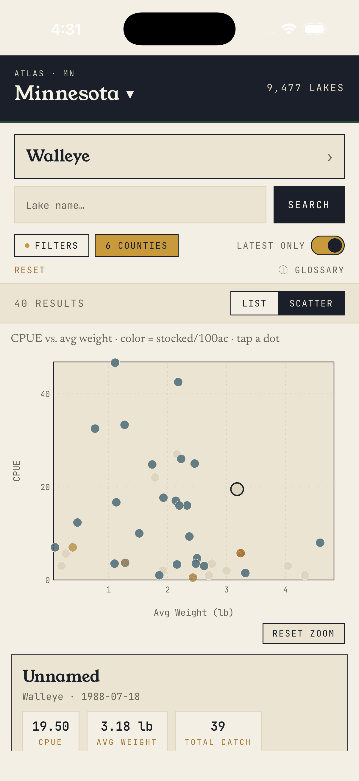
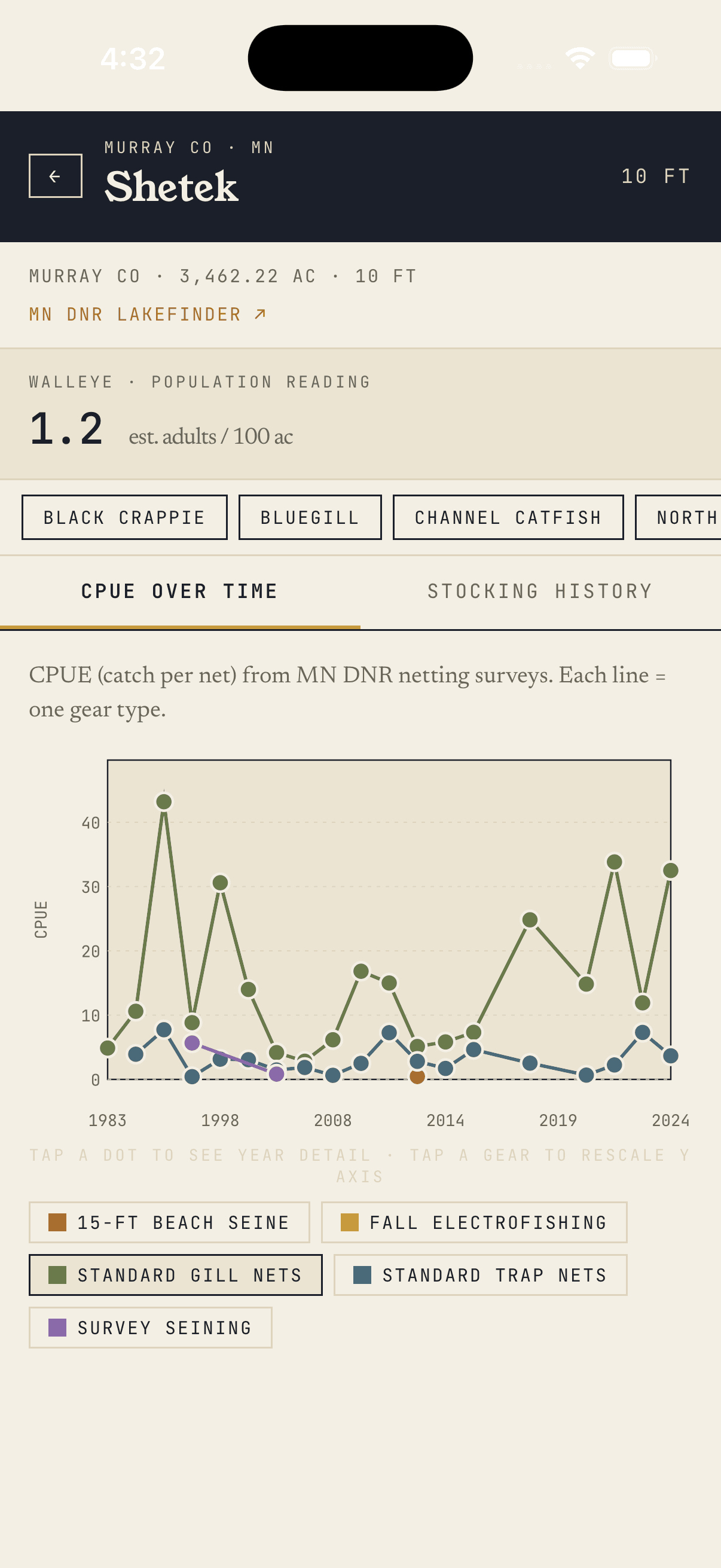
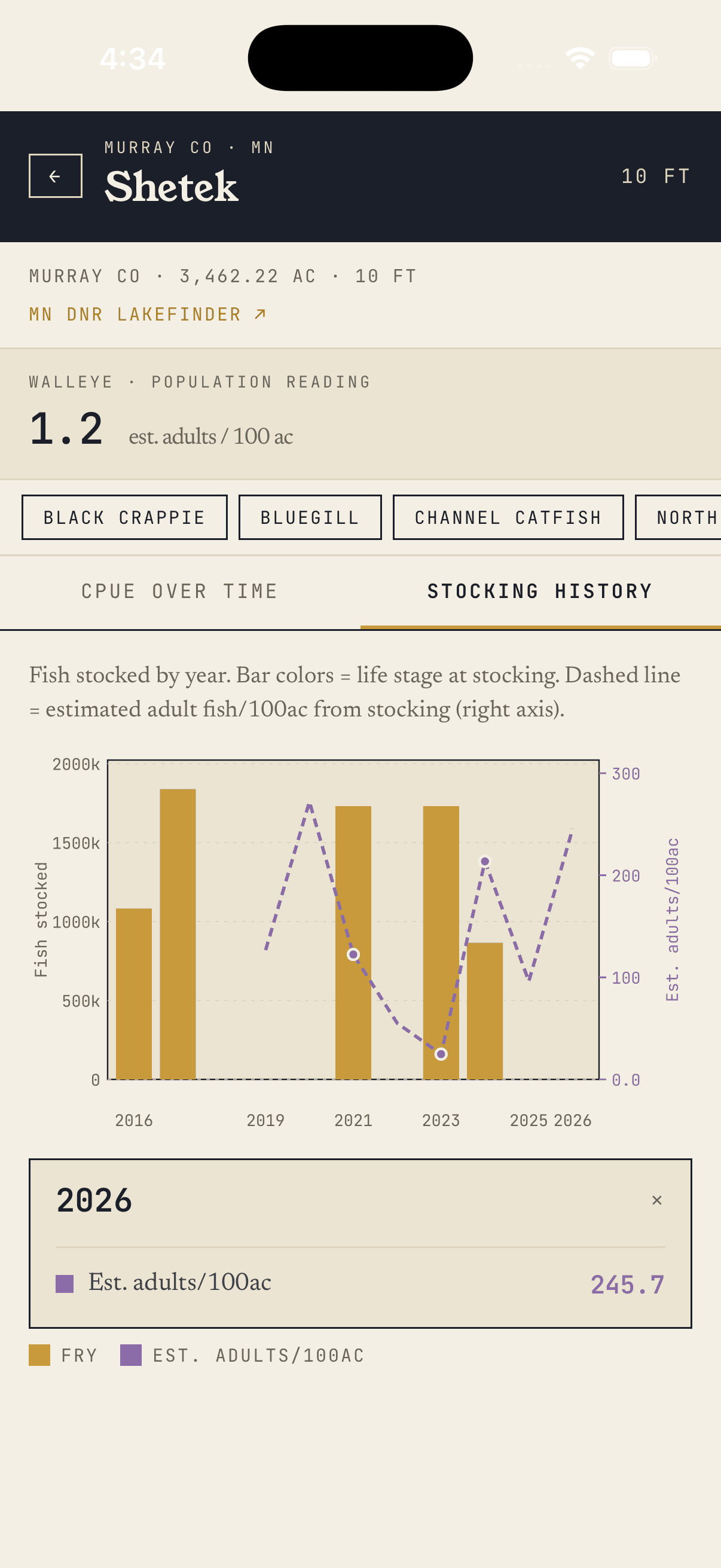
State biologists pull nets, weigh fish, and publish the results — usually as PDFs or county-level spreadsheets buried several clicks into agency websites. LakeLore gathers all of it, joins it to every stocking event on record, and renders it as one continuous picture of each lake.
Headline game fish
WalleyeNorthern PikeMuskellungeSmallmouth BassLargemouth BassLake TroutYellow PerchBlack CrappieBluegilland more
▸ Download · Free in Minnesota